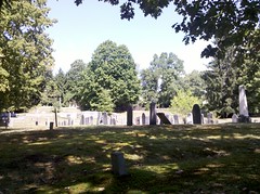
Getting out of the car, I stood for a second and looked at the cemetery from the wall in front of me. Then, I quickly moved up the hill (there is a semi-circular path for cars to get off the road) to look at the cemetery sign. Passing the opening in the stone wall, I noticed a well worn path in the center of the cemetery. After looking at the sign, I went back to the car, picked up my cell phone and went back to take a few photos.
It was a great first look on a lovely day. Arriving home, I immediately sent the photos I took to my email noting the naming convention of the few shots in my log book. Then, I went to the Town of Stow Web page and read the history. I pulled out Dave Lambert's Guide to Massachusetts Cemeteries, 2nd edition and found that Stow has 3 cemeteries. The one I briefly looked at last Spring was listed and another on Gleasondale Road.
Dave's book says that this cemetery was not always called Hillside. [Yes, there is a hill.] It was called Pilot Grove Hill Cemetery. A few days later, I found Pilot Grove farm just "up the road" from the cemetery on the opposite side of the street. Geography and history of the area are very important. I learned this the hard way with previous cemetery adventures.
In the Vital records, this cemeteries records will be listed as GR#2. He lists a date of 1812 which is either the year of consecration of the cemetery or the date on the oldest stone.


No comments:
Post a Comment