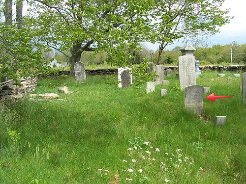
Long ago, this road was called Stewart Hill because generations of my ancestors lived on it. After the last Stewart sold the homestead, the road was renamed.
With every cemetery that you research with your ancestors buried in it, you should find out how it was identified in the past. This read is now called Wyssaup Road after the large nearby lake of that name. My little family cemetery finally made the map!

I am still trying to decide who the people are standing in front of the Stewart homestead. Gladys Chase sent me some obituaries from the North Stonington Historical Society, so I am working on them to try to figure this out.
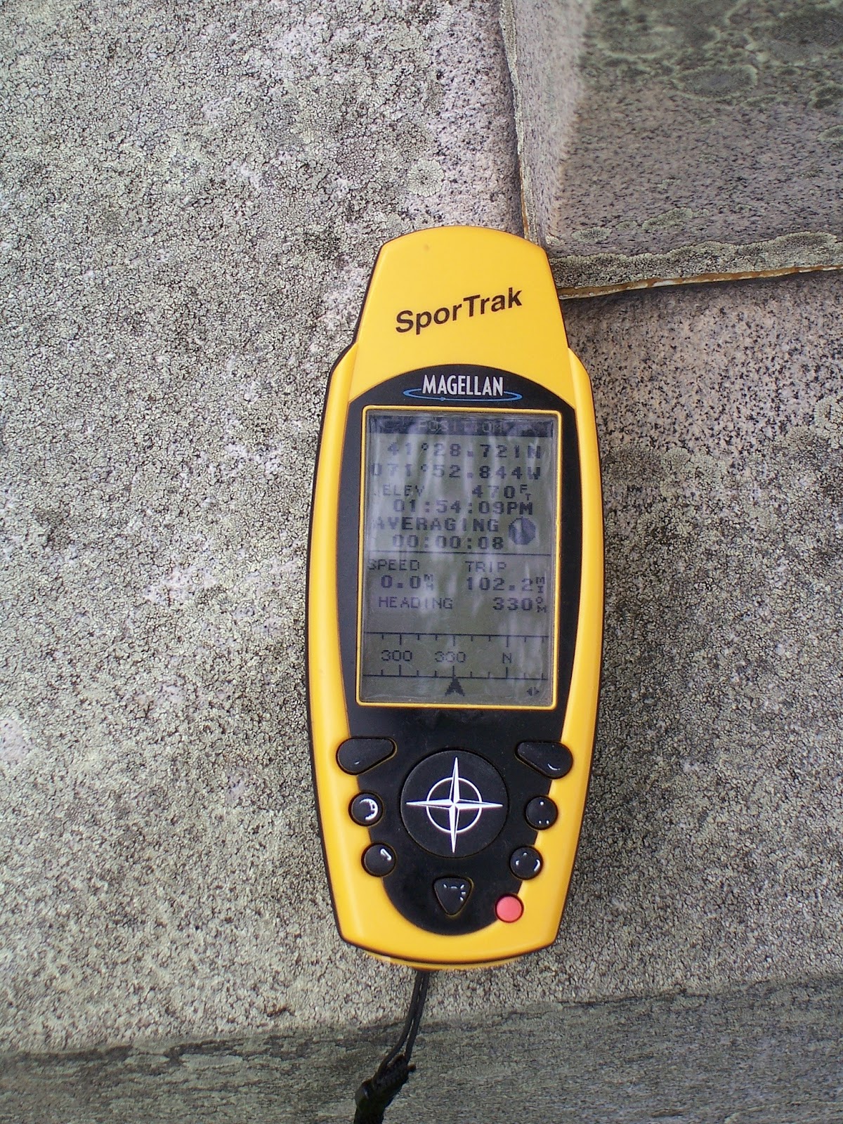
Brian shared his photo with the GPS he carries with him. 41degrees 28.721N, 071 degrees 52.844 W.

No comments:
Post a Comment