Teaching Cemetery Research: Locating a Map of the Cemetery
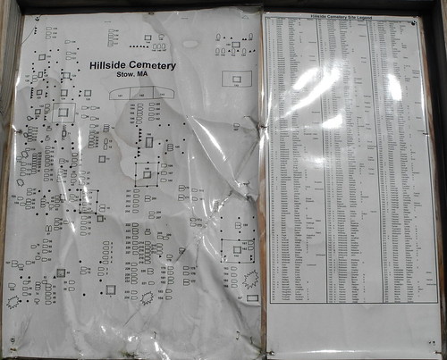
Located at the entrance of the Hillside Cemetery is a map and a list of the names of those buried here. According to several vital records of those buried here this is GR#2.
This makes sense because the oldest cemetery in the town of Stow is GR#1, Lower Village Cemetery.
I discovered that my new camera takes images that are so large that I can crop sections of this map and actually read the names on them. The shiny surface and the wrinkles are a problem. (wrinkles are always a problem; oh, I was talking about my face, I guess!)
I cropped the upper section of the left hand part of the map and an using it to work on the photos I took.

2 comments:
I love it when they have maps at the cemetery. Many years ago - my folks were at Rose Hill Cemetery in Kirkman Corners, IA looking for my great great grandparents. Mom and Dad walked the entire cemetery and found the graves - but when they left, they found a map of the cemetery and a census of the inhabitants at the other entrance. Mom said that ticked her off...after all the walking they had just done and it was at the other entrance!
Hi Midge, Nice picture. Your new camera is a good one! Good that you have taken snapshots of the cemetery map. Good as a reference for you and a back-up for history's sake.
Post a Comment